GIS PROJECTS
GIS FOR UTILITIES [ GAS ] [ POWER ]
-
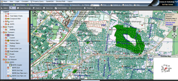
Geoinformatics Division of Science and Technology Park, Pune is engaged in implementing and adapting to the changed environment of GIS Mapping and offering Web based GIS Solution to City Wide Gas Distribution Network(CGDN) Companies as per the directives of CGD Regulatory Body Petroleum Natural Gas Regulatory Body (PNGRB).
STP has done mapping exercise using Remote Sensing and GIS for Gas Pipeline Distribution Network Management System. The work involved generation of digital base map for the city of using GeoEye satellite image, DGPS and Pipeline Line locator based detection, marking and drawing of already laid gas pipe lines within the city, designing of new and probable gas pipelines to be laid in new and developing area. The output gas pipeline networks along with its associated utilities were later viewed on a Web GIS Platform through Open PRP product developed. This application acted as a good tool for fast and efficient decision along with customization made to respond to an event of disaster through Web-GIS platform.
URBAN GIS & eGOVERNANCE
- MUNICIPAL GIS
- MAPPING URBAN POOR
- LAND BOUNDARY DEMARCATION
- GIS BASED CARPET AREA ANALYSIS
GIS FOR PLANNING
ENVIRONMENT & DISASTER MGMT.
SPECIALIZED MAPPING INITIATIVES
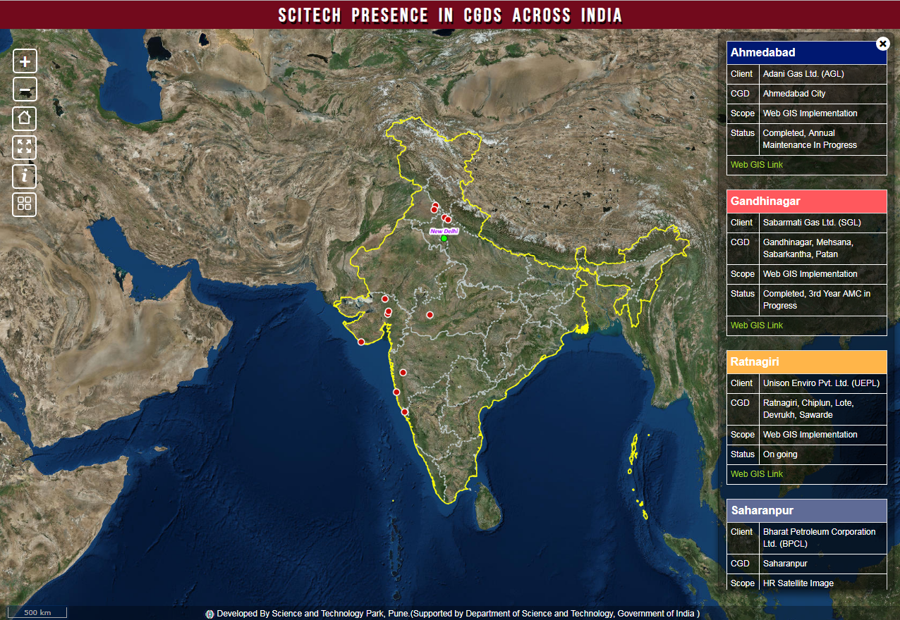
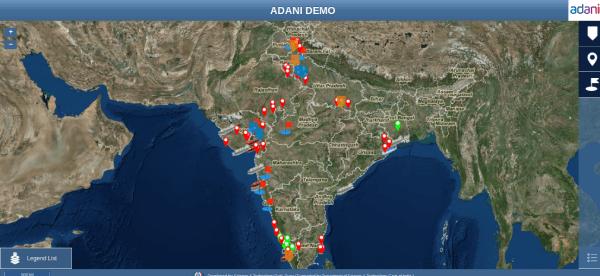
Scitech Presence :: CGDs
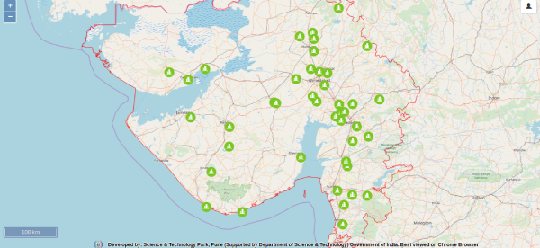
A Web Dashboard showing Science and Technology Park's implementations across India in City Gas Distribution companies
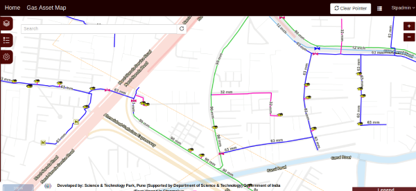
Gas Utility :: Web GIS
Web GIS implemented at Adani Gas Ltd.
Survey, Gas Assets on GIS Platform,
Managing Assets on Web GIS, Low and Distributed CAPEX & OPEX,
Android Based Incident Reporting System
Gas Utility :: Data Sharing
Web Services for Data Sharing with Local Administration & Disaster Management Authorities in case of Gas leakage incidents
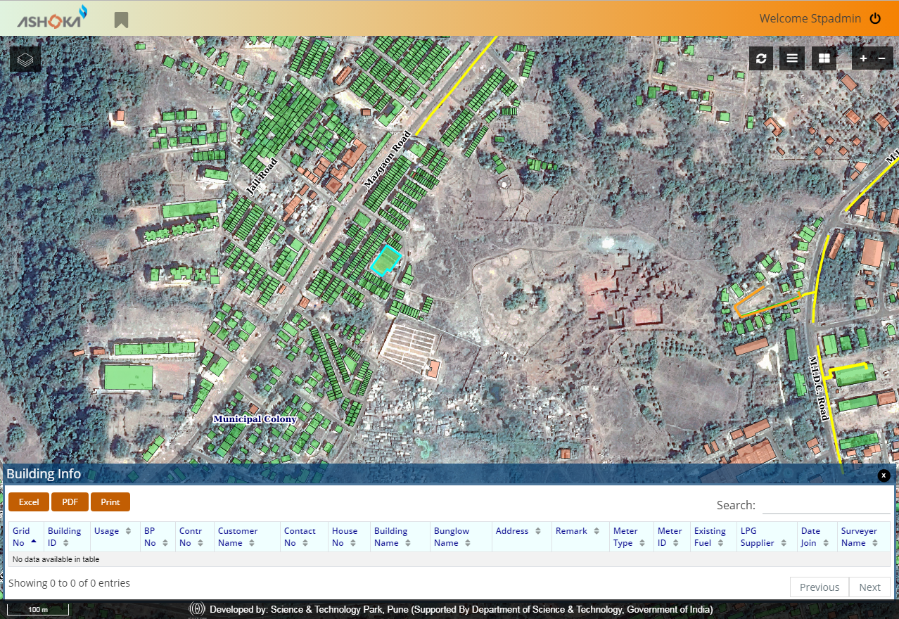
Gas Utility :: Landbase Module
An implementation of Landbase display in GIS, for UEPL . This module is extremely useful for planning purpose
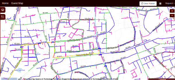
Gas Utility :: GIS Overview
A Web Dashboard showing an overview of a CGD company's GAs location and statistics, also shows transmission grids, LNGs etc for planning
Web GIS RMC
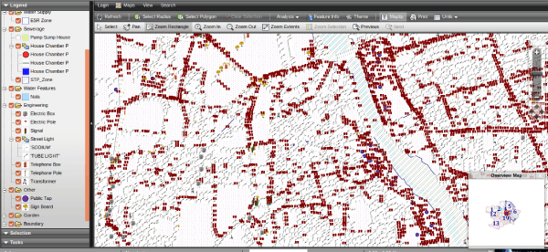
Web GIS for Rajkot Municipal Corporation
Surveyed with principle of “Total Station Survey”.Preparation of Base Map using satellite images. Creation of Layers of Geo-Spatial Information such as Water supply,sewerage network, street lights, road network and other infrastructure.
Analysis of geo-Spatial data and provision of basic Infrastructure services.GIS based Integrated city wide housing mapping and slum identification.
Web GIS PCMC
Web GIS for Pimpri Chinchwad Municipal Corporation
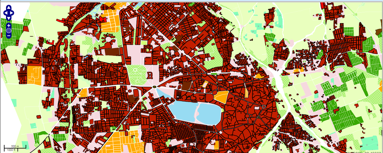
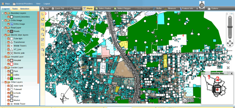
Scitech Park is closely working with Municipal Corporations and Urban Local Bodies to collect, collates and create GIS database for various municipal departments. GIS enablement of the city municipal system has enhanced decision making process, smooth, transparent and effective with high degree of sensibility and ownership for different spatial and aspatial municipal records. All municipal records including details of property tax, utilities (water pipelines, roads, sewer lines and storm water drains) are mappedand converted into GIS network system with relevant database attached for operational geospatial analysis. Apart from this property tax details, professional tax details, details of licenses and lease issued and property usage are covered under uniform and standard GIS platform
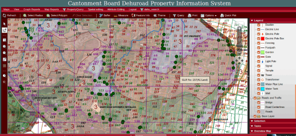
Property Information System
Dehu Road Property Information System
Scitech Park has contributed in a vital way by transforming the digital and e-governance initiatives of Government of India. It has helped urban local bodies in transforming their critical municipal records into GIS platform by adopting the modern tools of geographical information system and remote sensing. Scitech Park has further developed a light weight open source based Web GIS package called Open PRP Suiteflexible enough to demonstrate GIS datasets. Such digital transformations has helped in plugging revenue leakages and benefited the revenue earnings of ULB’s manifold.
Land Information System
Dehu Road Land Information System
Scitech Park has contributed in a vital way by transforming the digital and e-governance initiatives of Government of India. It has helped urban local bodies in transforming their critical municipal records into GIS platform by adopting the modern tools of geographical information system and remote sensing. Scitech Park has further developed a light weight open source based Web GIS package called Open PRP Suiteflexible enough to demonstrate GIS datasets. Such digital transformations has helped in plugging revenue leakages and benefited the revenue earnings of ULB’s manifold.
RAY Bhavnagar
Government of India announced a National level scheme for slum dwellers and the urban poor named as Rajiv Awas Yojana (RAY), aimed at creating a Slum Free India by providing support to states to assign property rights to slum dwellers. Science and Technology Park was entrusted to conduct GIS Mapping using satellite images, Total Station, Socio-economic Survey, RH/RD Planning, preparation of Detailed Project Report under the RAY for Urban Local Bodies
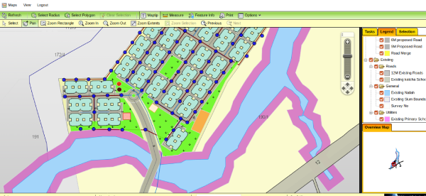
RAY Jamnagar
Scitech Park was engaged in centrally funded flagship program for urban poor aimed at establishing India as a Slum Free under Awas Yojana Scheme. The plan lays outline and sets modalities for slum rehabilitation, redevelopment and making financial provisions and establishing state level consensus on legislating property rights to the slum dwellers so that they can be brought gradually into the main stream of a city’s cultural, social and financial progress. The approach adopted was holistic and departmental as well as stakeholder level meetings were held where detailed project methodology was explained to all concerned along with the details of socio-economic survey and GIS based topographic survey and plan for transformation.
CTP Project
Secured balanced and planned development of the urban areas has now become the order of the day. Conversion of Draft Town Planning Schemes into Final Town Planning schemes requires systematic and meticulous utilization of land parcels for the benefit of the people. Digital representation of all Town Planning Schemes through a centralized GIS enabled web platform shall help urban planners and citizens for transparent representation of records for all purposes. Scitech Park has developed an Open PRP Suite exclusively for Town Planning.
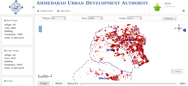
AUDA Time Series Analysis
Scitech Park has been engaged in converting estate department old records pertaining to Development Plan, Tikka Sheets, CTS Plan and Layout Plan. Property Type documents were georeferenced using DGPS. These georeferenced sheets were edge-matched and were further used by the estate department to seamlessly integrate it with their already existing ERP based GIS module. This exercise thus digitally transformed all old official records into GIS platform.
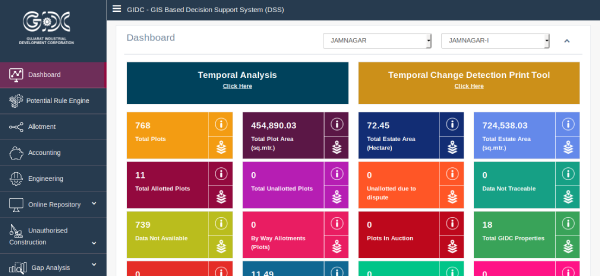
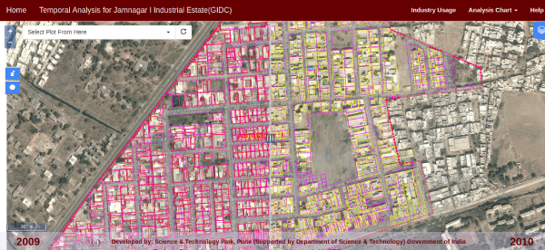
GIDC Temporal WebGIS
Satellite image based spectral analysis of two or more time period data has been conducted for different projects to undermine the changes and potentially changing areas especially with respect to increase in built-up area , Striking changes can be observed for urbanization, deforestation and land diversion .Using high resolution satellite images we are able to quantify the increasing or decreasing trends in terms of area and volume
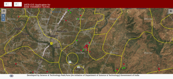
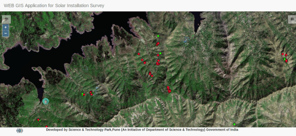
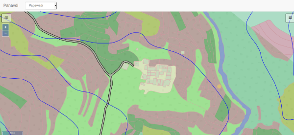
Solar Project (17 villages 30 vasti)
Solar Installations Survey & Maintenance Project (17 villages 30 vasti)
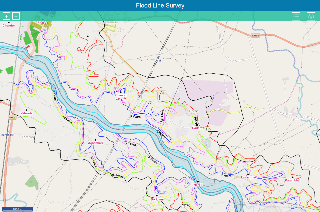
Flood-Lines Mapping & Survey
Flood inundation mapping and demarcation of flood hazard zones helps in establishing risk potential for assets having insurance value. Based on precipitation data and local hydro-geological parameters; rainfall-runoff modeling is performed to establish areas that shall get inundated based upon scenarios generated post precipitation frequency analysis. This is a unique initiative taken up by the GIC Re wherein risk based reinsurance and coverages shall be studied to so that capabilities for assessing flood peril impact and accumulation control for insurance and reinsurance purpose
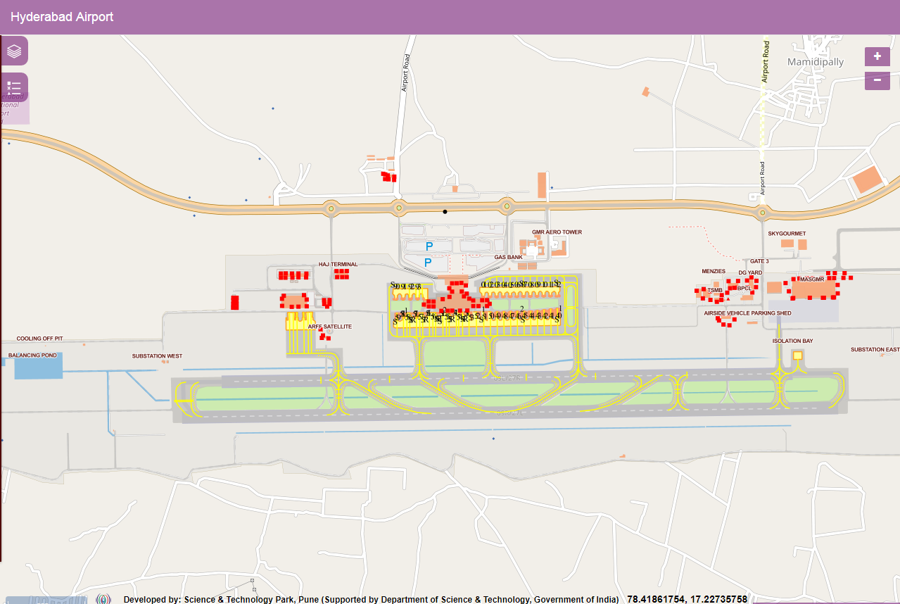
Indoor Mapping
A Pilot Project done for Indoor Mapping of Hyderabad Airport. Here, the mapping has been done using the floor plan supplied to us.

